sumitraenterprises111@gmail.com - View Mobile Number
- Send SMS Send Email


8.29 Lac / Piece
| Business Type | Manufacturer, Supplier |
| Power Consumption | 30 W Typical, 60 W Max |
| Dimensions | 152 X 110 X 169 Mm |
| Weight | 930 G ± 10 G |
| Click to view more | |
Product Details
IP Rating
IP54 (Dust & Water Resistant)
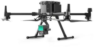
Supported Drone
DJI Matrice 300 RTK
Operating Temperature
-20°C To 50°C
Storage Temperature
-20°C To 60°C
LiDAR Accuracy
3 Cm @ 100 M
Detection Range
Up To 450 M (80% Reflectivity)
Point Rate
Max. 480,000 Pts/s (multiple Returns)
RGB Camera
1-inch CMOS, 20 MP
Photo Resolution
5472 X 3648 Max
Video Resolution
4K @ 30p (H.264)
Aperture Range
F/2.8 - F/11
Shutter Speed
1/8000 - 8s (Electronic), 1/2000 - 8s (Mechanical)
IMU Accuracy
Yaw: 0.3° RTK, 0.15° Post-process
Point Cloud Modes
Reflectivity, Height, Distance, RGB
Data Storage
MicroSD Up To 256 GB (UHS-I, Speed Grade 3)
Compatible Software
DJI Terra - Supports PNTS/LAS/PLY/PCD/S3MB
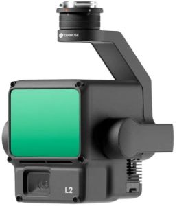
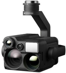
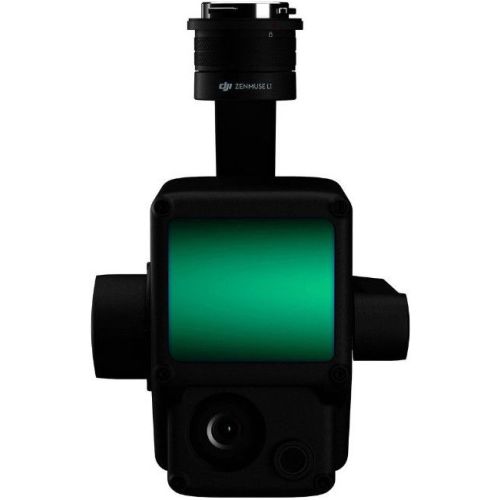
DJI Zenmuse L1 – The Ultimate Solution for Aerial LiDAR Mapping
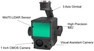
The DJI Zenmuse L1 is not just another payload—it’s a complete aerial LiDAR solution designed for professionals who need accuracy, speed, and reliability. With its Livox LiDAR module, a 1-inch RGB camera, and a high-precision IMU, the L1 delivers real-time 3D data that transforms how industries like surveying, forestry, construction, and infrastructure inspection work with aerial data. Built tough with an IP54 rating, it is ready to handle challenging field conditions while providing crystal-clear point clouds and accurate 3D models.
Key Features of DJI Zenmuse L1
1. Powerful Livox LiDAR Sensor – Precision at Its Core
The L1’s LiDAR system offers a ranging accuracy of up to 3 cm at 100 meters, with a maximum detection range of 450 m at 80% reflectivity. Supporting up to 3 returns and delivering a point rate of 480,000 pts/s in multiple-return mode, it ensures dense and highly accurate mapping data even in complex terrains.
2. High-Resolution RGB Mapping Camera – Color with ClarityEquipped with a 1-inch CMOS sensor and 20 MP resolution, the RGB camera adds vibrant details to point clouds. With multiple photo sizes, a mechanical shutter, and adjustable aperture from f/2.8 to f/11, it captures true-to-life imagery. Video recording at 4K (3840×2160 30p) ensures seamless integration of visuals into mapping workflows.
3. Integrated IMU – Stability and Accuracy TogetherWith an IMU update frequency of 200 Hz, ±8 g accelerometer range, and yaw accuracy as precise as 0.3° real-time (0.15° in post-processing), the L1 ensures every point cloud dataset is aligned perfectly. This allows surveyors and engineers to trust every measurement in the final model.
4. Real-Time Point Cloud Visualization – Instant Data ConfidenceThe L1 supports real-time point cloud coloring modes, including reflectivity, height, distance, and RGB. Operators can immediately verify data quality mid-flight, reducing re-flight chances and ensuring complete coverage of critical sites without wasting time.
5. Rugged and Reliable – Built for the OutdoorsWith an IP54 rating, the Zenmuse L1 is resistant to dust and water, making it reliable in harsh conditions. Whether working in rain, heat, or dusty sites, it continues to perform without compromise. Its operating temperature ranges from -20°C to 50°C, ensuring consistent results in extreme environments.
6. Smooth Data Processing – Compatible with DJI TerraThe L1 integrates seamlessly with DJI Terra, supporting standard point cloud formats such as PNTS, LAS, PLY, PCD, and S3MB. This allows professionals to easily process, analyze, and export data for industry-standard use. From raw point cloud to actionable 3D maps, the workflow remains streamlined.
7. Versatile Applications – One Sensor, Many IndustriesForestry, mining, power line inspection, and construction all benefit from the L1’s versatility. With the ability to see through vegetation, capture urban structures, and deliver accurate surface models, it becomes a multipurpose tool for professionals across industries.
Looking for "Zenmuse L1" ?
Piece