sumitraenterprises111@gmail.com - View Mobile Number
- Send SMS Send Email

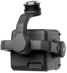
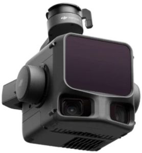

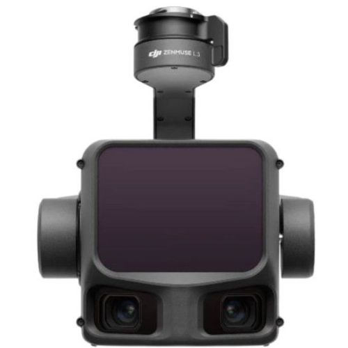
14.89 Lac / Piece
| Business Type | Manufacturer, Supplier |
| Weight | 1.60 Kg |
| Dimensions | 192×162×202 Mm |
| Power | 64 W (typical), 100 W (max) |
| Click to view more | |
Product Details
Protection Rating
IP54
Operating Temperature
-20°C To 50°C
Accuracy (120m)
Vertical: 3 Cm, Horizontal: 4 Cm
Accuracy (300m)
Vertical: 5 Cm, Horizontal: 7.5 Cm
Detection Range
Up To 2000 M
Laser Wavelength
1535 Nm
Laser Safety
Class 1
Sensor
4/3 CMOS, 100 MP
Lens
28 Mm, F/2.0–f/11
Video Resolution
4K@30fps
Gimbal
3-axis, ±0.01° Accuracy
Positioning
RTK-enabled, Horizontal 1 Cm + 1 Ppm
Supported Drone
DJI Matrice 400
Software
DJI Pilot 2, DJI Terra, DJI Modify, FlightHub 2
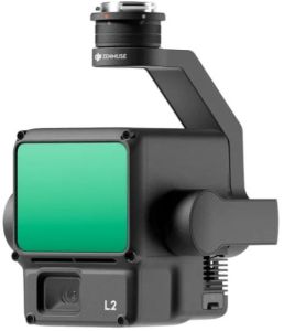
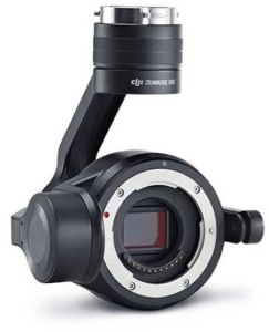
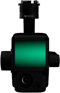
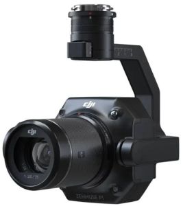
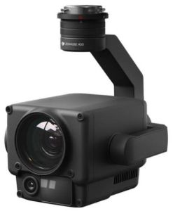
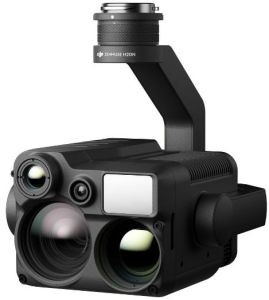
DJI Zenmuse L3 – Precision LiDAR Meets Power of Vision
The DJI Zenmuse L3 is not just another aerial sensor—it’s a powerhouse of laser precision and visual intelligence designed for professional mapping, surveying, and 3D modeling. Built for the DJI Matrice 400, it combines high-accuracy LiDAR technology with a 100MP RGB camera, giving you crystal-clear point clouds and rich imaging data in a single flight. Whether you’re mapping cityscapes, forests, or utility lines, the L3 delivers the kind of accuracy that turns “almost perfect” into “exactly right.”
Key Features
1. Dual Power: LiDAR + RGB Mapping in One
The Zenmuse L3 smartly merges LiDAR scanning and RGB imaging to create detailed, colorized 3D maps in one seamless workflow. The LiDAR system detects distances and shapes, while the 100MP RGB camera adds true color to every point cloud. This powerful duo means you don’t need two separate payloads—saving time, effort, and battery life during missions. For surveyors and inspection teams, it’s like having a laser scientist and a photographer working together mid-air.
2. Outstanding Accuracy That Never Misses a BeatWhen you’re mapping from the sky, every centimeter counts. At 120 meters, the L3 achieves an impressive vertical accuracy of 3 cm and horizontal accuracy of 4 cm. Even at 300 meters, it maintains 5 cm vertical and 7.5 cm horizontal precision. These results come from advanced calibration, real-time IMU data, and DJI’s flight algorithms. In short, whether you’re scanning a rooftop or a mountain, you can trust the data down to the centimeter.
3. Unbelievable Detection Range for Any TerrainWith a detection range of up to 2000 meters (at 80% reflectivity), the Zenmuse L3 can handle long-distance scans like a pro. It adjusts its pulse rate automatically for optimal range, ensuring high-quality data even under bright sunlight or complex lighting conditions. From dense forests to shiny metal structures, the L3 keeps its eyes sharp—no area left unseen, no detail left unscanned.
4. Advanced Laser Precision and SafetyThe L3 uses a 1535 nm laser wavelength—a class 1 eye-safe beam that ensures accuracy without safety risks. Its 0.25 mrad divergence produces a tight laser spot for sharp point clouds. With absolute ranging accuracy of ±10 mm, the system delivers clean and consistent results. Even the smallest wires or pole edges are detected clearly, helping surveyors map utilities with unmatched detail.
5. Three Powerful Scanning ModesDJI knows one scanning pattern doesn’t fit all. That’s why the L3 offers Linear, Star-Shaped, and Non-Repetitive Scanning Modes. The Linear mode is great for straightforward mapping routes, while the Star and Non-Repetitive modes capture complex structures and uneven terrains with 80° × 80° coverage. So whether you’re scanning a flat construction site or a hilly forest, the L3 adapts like a professional cameraman who never misses an angle.
6. Incredible RGB Camera for Real-World ColorThe integrated 4/3 CMOS 100MP RGB camera is not just there for looks—it’s there for accuracy. With a 28mm lens and an aperture range of f/2.0–f/11, it captures every shade and texture of your landscape. The camera supports 4K video recording at 30fps, allowing you to visualize your survey area in real-time. Each image aligns perfectly with LiDAR data, giving you detailed, colorized models ready for analysis or presentation.
7. Ultra-Precise Gimbal StabilizationThe L3’s 3-axis gimbal ensures total stability even in windy or high-speed conditions. With an angular accuracy of ±0.01°, your LiDAR and camera data remain perfectly aligned during flight. Its controllable pitch range from -120° to +60° lets you scan directly below or slightly forward as needed. The gimbal’s smooth motion guarantees that every scan remains crisp, stable, and beautifully structured.
8. Seamless RTK Positioning & Orientation SystemThanks to its advanced RTK-enabled POS system, the Zenmuse L3 achieves 1 cm horizontal and 1.5 cm vertical accuracy in positioning. The system continuously updates at 200 Hz, combining GNSS and IMU data for pinpoint geolocation. It means your mapping results won’t just be visually accurate—they’ll be geographically precise too. For professional surveyors, this makes ground control points almost unnecessary in many scenarios.
9. Built Tough for Every MissionDJI built the Zenmuse L3 with an IP54-rated body, keeping it protected from dust and light rain. Operating between -20°C to 50°C, it’s ready for fieldwork in deserts, snowy mountains, or humid forests. Its compact 1.6 kg design ensures flight efficiency while maintaining balance and stability even on longer missions. Simply put, it’s tough enough to go wherever your data needs to go.
10. Smart Software EcosystemFrom flight planning to data processing, the L3 fits neatly into DJI’s professional workflow. Use DJI Pilot 2 for mission setup, DJI Terra for post-processing and point cloud optimization, and DJI Modify for editing and refining models. If you prefer cloud management, DJI FlightHub 2 keeps your team connected with real-time data sharing and analysis. The system supports multiple output formats like LAS, LAZ, PLY, PCD, and S3MB, making integration with industry software effortless.
Looking for "Zenmuse L3" ?
Piece